Day 157-A Much Better Day, But Still Long
Aug 22- 11.9 (plus 1 mile from Guyot) miles-Guyot Campsite to Crawford Notch Campground- AT mile-1847.6
As I was hiking down Guyot, I met a guy going southbound. His name was Turtle. He said he was hiking with two other guys, Upstream, and Nat Geo. When he mentioned Upstream, I asked if Upstream had a brother named Robert (Frosty). Frosty had told me his brother was thru-hiking , and that his name was Upstream. Sure enough, it was him! Upstream and Nat Geo were a bit behind Turtle. I kept asking hikers their trail name as they went by. Finally, Upstream came by. I told him that I knew his brother. We talked for a bit, and I asked if I could take his photo.
Upstream is the same age as Sure Foot.

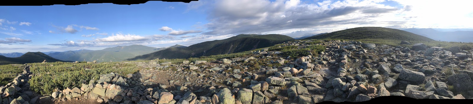
If you zoom in, you will see a trail going along that boulder field. From where we were up at Zeacliff, that was 1.6 trail miles away (actually, the start of that part was 1.6, it was more to get to that part).

I was straddling the water going down.
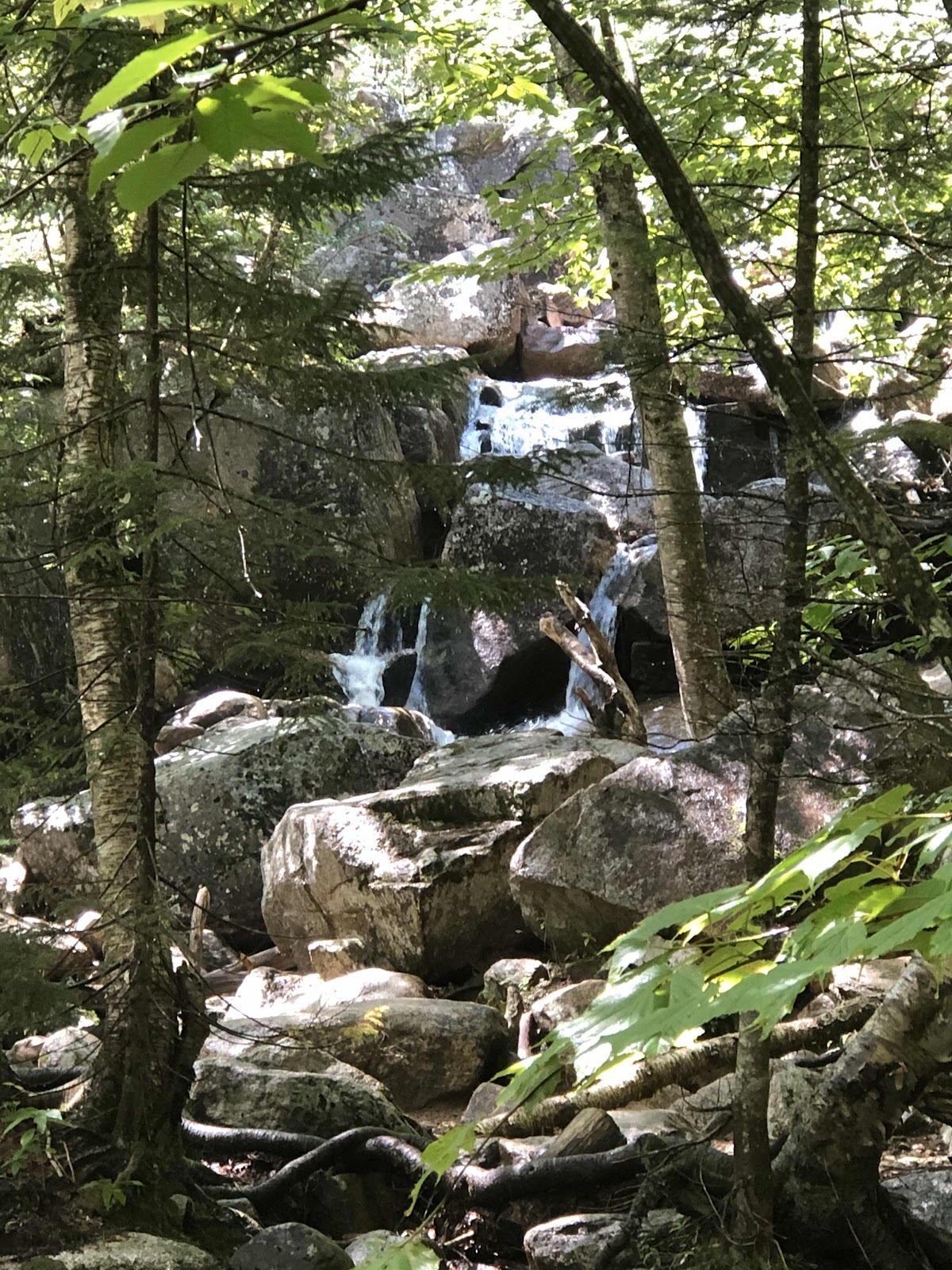
There are a few falls.

My kind of trail!

Coming out to the boulder field.
That is Zeacliff way up there...where we had been earlier.

Looking up the boulder field from the trail.

Today was another long day, but it was way better than yesterday. The terrain wasn’t as scary difficult, there were not any long steep climbs (although there was a long downhill), and there was a long section of mostly flat dirt path.
I headed out before Sure Foot, as usual. It was a mile back to the AT from the Guyot campsite, then an easy climb up Mt. Guyot itself. Yesterday’s little climb was called Guyot Spur.
As I was hiking down Guyot, I met a guy going southbound. His name was Turtle. He said he was hiking with two other guys, Upstream, and Nat Geo. When he mentioned Upstream, I asked if Upstream had a brother named Robert (Frosty). Frosty had told me his brother was thru-hiking , and that his name was Upstream. Sure enough, it was him! Upstream and Nat Geo were a bit behind Turtle. I kept asking hikers their trail name as they went by. Finally, Upstream came by. I told him that I knew his brother. We talked for a bit, and I asked if I could take his photo.
Upstream is the same age as Sure Foot.
Later we met Nat Geo. He had some good info for us about a stealth site 1 1/2 miles before Madison Hut after Mt. Washington. We hope we can get to Madison, but as we know, things don’t always work out the way we hope. It gives us an option.
As we continued on, we came to the side trail out to Zeacliff for a view.
If you zoom in, you will see a trail going along that boulder field. From where we were up at Zeacliff, that was 1.6 trail miles away (actually, the start of that part was 1.6, it was more to get to that part).
It was looking pretty ominous in the rain department, so I put my pack cover on, and also put on my rain jacket. We were going downhill, so I wasn’t worried about getting too hot.
It was 1.3 from Zeacliff down to Zealand Falls Hut. It was slow, but not too treacherous. Just before we got to the hut, I started to feel a few raindrops. At the hut, we got our packs off, and went in to order some food. They had quesadillas and a vegan chocolate cake. I also had hot chocolate (besides water, drink options are limited to coffee, tea, and hot chocolate). Sure Foot had the same, but with coffee. Just as we were eating our food, the sky opened up and it started to pour. Good thing we were under cover! Some hikers we had passed ended up coming back to the hut. By the way, there were a lot of day hikers! Of course, it was Saturday. I forgot to take any photos of the hut. I did take these photos of part of Zealand Falls.
I was straddling the water going down.
There are a few falls.
The rain stopped, and we continued down from the hut. In .2 miles, we hit that which I had been looking forward to all day. It was supposed to be 4 flat miles of dirt path.
My kind of trail!
Well, there was a substantial amount of flat dirt path, but it wasn’t all like that. Still it was a respite from the sustained downhills.
Coming out to the boulder field.
That is Zeacliff way up there...where we had been earlier.
Looking up the boulder field from the trail.
The “flat dirt path” officially ended, and we were walking on boards across swampy stuff. You might think that is easy. It would be if the boards were all in good repair...they’re not.
Shortly after the turn for the Ethan Pond campsite (where we were supposed to have made it to last night), we started a long over 2 1/2 mile downhill. It wasn’t really bad, but by then, my knees were done. For most of the descent, there was a couple behind us. At one point when they were closer, I asked if they wanted to pass. They said no, because they weren’t going any faster.
We finally reached the bottom of the downhill, and the trail junction to Ripley Falls. Thane introduced himself, and we told him we were thru-hiking. We also found out the reason they weren’t going faster. Thane’s shoe was falling apart. He had taped it with duct tape, but the sole was flopping.
Early in the morning when I was up on Guyot, I had texted Lorri to tell her we would be later because we had stopped at Guyot. The rest of the day, I had checked to see if we had service so I could call her (she was going to pick us up at Crawford Notch, and take us to the campground). We had no service the entire rest of the day. As we were walking toward the parking at Crawford Notch, I asked Thane if they had a vehicle there. They did, so I asked if they could give us a ride to Crawford Notch General Store and Campground. They said it was no problem. Just as we got to their pickup (king cab), it started to rain again. Whew, just made that one too!
We got to the campground hoping to get a cabin. Because it’s the weekend, there were no cabins. So we got a tent site. Turns out we got the last tent site! They have a two day minimum, but we needed two days anyway because the good weather window for Monday over Mt. Washington had changed to possible thunderstorms. So, we have a zero here to try and figure out how to get the weather report for Mt. Washington...with no service. We also need to try to contact Lorri, and let her know we are okay. She is at the AMC Highland Center the other side of Crawford Notch.
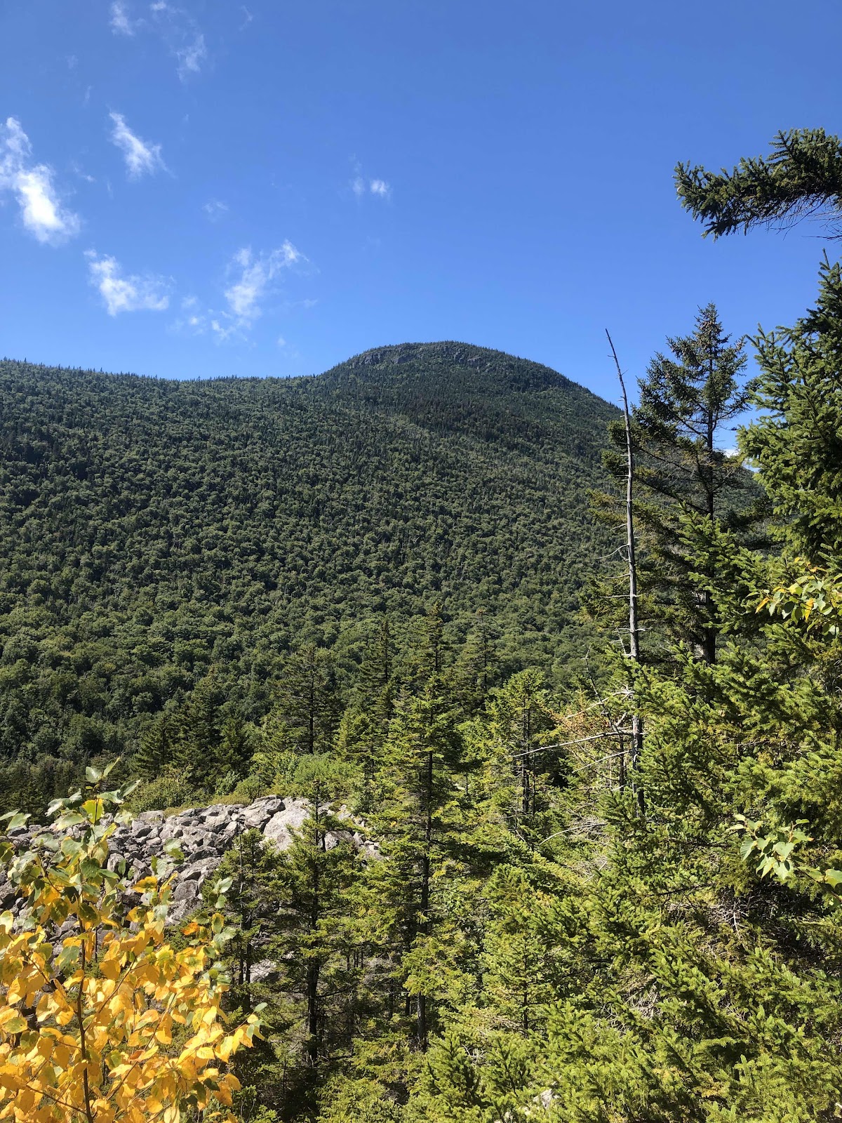
Mostly, it was a lucky day for us, but still some challenges. Here’s a parting shot of a creek.


Comments
Post a Comment